
Bustasur topographic map
Click on the map to display elevation.
Bustasur
Bustasur es una localidad del municipio de Las Rozas de Valdearroyo (Cantabria, España). En el año 2012 contaba con una población de 37 habitantes (INE). La localidad se encuentra a 819 metros de altitud sobre el nivel del mar, y a 6 kilómetros de la capital municipal, Las Rozas.
About this map
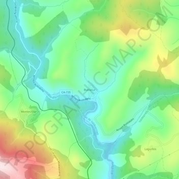
Name: Bustasur topographic map, elevation, terrain.
Location: Bustasur, Las Rozas de Valdearroyo, Cantabria, 39213, España (42.91656 -4.05232 42.95656 -4.01232)
Average elevation: 942 m
Minimum elevation: 788 m
Maximum elevation: 1,243 m