
Make a donation
Gear up for your next adventure:
As an Amazon Associate, this site earns from qualifying purchases at no extra cost to you.
Rarotonga topographic map
Click on the map to display elevation.
Make a donation
Gear up for your next adventure:
As an Amazon Associate, this site earns from qualifying purchases at no extra cost to you.
About this map
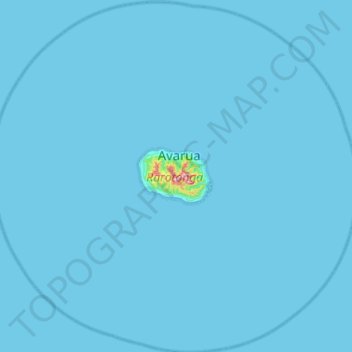
Name: Rarotonga topographic map, elevation, terrain.
Location: Rarotonga, Cook Islands (-21.47922 -160.04748 -20.99499 -159.50776)
Average elevation: 3 m
Minimum elevation: 0 m
Maximum elevation: 502 m
Make a donation
Gear up for your next adventure:
As an Amazon Associate, this site earns from qualifying purchases at no extra cost to you.
Other topographic maps
Click on a map to view its topography, its elevation and its terrain.
Takutea
Takutea is an oval island roughly 1 mile (2 kilometres) long and 3/4 of a mile across. It consists entirely of sand, with a maximum elevation of 20 feet (6 metres). The island is surrounded by a narrow reef.
Average elevation: 1 m