Geolocate

Harapan topographic map

Click on the map to display elevation.

About this map

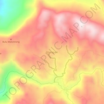
Name: Harapan topographic map, elevation, terrain.

Location: Harapan, Barru, South Sulawesi, Sulawesi, Indonesia (-4.55762 119.75050 -4.51762 119.79050)

Average elevation: 735 m

Minimum elevation: 285 m

Maximum elevation: 989 m

Gear up for your next adventure:

Lightweight Backpacking Tent - Compact tent for efficient hiking trips
🧢Sun Protection Cap - Breathable cap to protect from sun exposure
🛁Quick-Dry Microfiber Towel - Space-saving towel that dries rapidly on the move
🩹Compact First Aid Kit - Pre-packed essentials for common trail injuries
🐕Hiking Dog Pack - Let your canine companion carry their own water and food

As an Amazon Associate, this site earns from qualifying purchases at no extra cost to you.