
Mannarkkad topographic map
Click on the map to display elevation.
Mannarkkad
Mannarkkad is located at 10°59′N 76°28′E / 10.98°N 76.47°E / 10.98; 76.47. It has an average elevation of 76 m (249 ft). Mannarkkad is located 30 km west of Perinthalmanna. It is situated 40 km north-west of the district headquarters Palakkad, on the way to Kozhikode, which is 100 km north-west. Mannarkkad is located in the foothills of the Western Ghats.
About this map
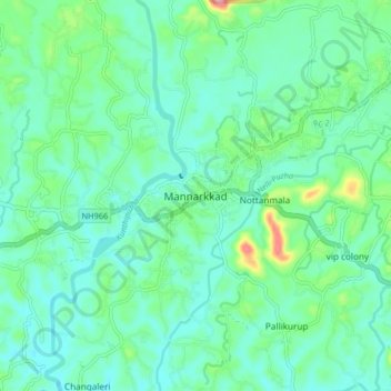
Name: Mannarkkad topographic map, elevation, terrain.
Average elevation: 80 m
Minimum elevation: 47 m
Maximum elevation: 201 m