
Make a donation
Gear up for your next adventure:
As an Amazon Associate, this site earns from qualifying purchases at no extra cost to you.
Dießen topographic map
Click on the map to display elevation.
Make a donation
Gear up for your next adventure:
As an Amazon Associate, this site earns from qualifying purchases at no extra cost to you.
About this map
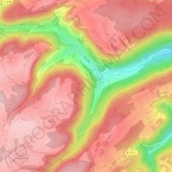
Name: Dießen topographic map, elevation, terrain.
Average elevation: 605 m
Minimum elevation: 441 m
Maximum elevation: 683 m
Make a donation
Gear up for your next adventure:
As an Amazon Associate, this site earns from qualifying purchases at no extra cost to you.
Other topographic maps
Click on a map to view its topography, its elevation and its terrain.
Grünmettstetten
Deutschland > Baden-Württemberg > Landkreis Freudenstadt > Horb am Neckar
Average elevation: 610 m
Rexingen
Deutschland > Baden-Württemberg > Landkreis Freudenstadt > Horb am Neckar
Average elevation: 531 m
Talheim
Deutschland > Baden-Württemberg > Landkreis Freudenstadt > Horb am Neckar
Talheim entwickelte sich entlang der Steinach, die die Hochfläche von West nach Ost tief durchschneidet. Heute wohnen die meisten Bewohner außerhalb der alten Ortskerne der beiden Teilgemeinden in den beiden Neubausiedlungen auf der Höhe. Unten im Tal befinden sich.
Average elevation: 574 m
Isenburger Höfe
Deutschland > Baden-Württemberg > Landkreis Freudenstadt > Horb am Neckar > Betra
Average elevation: 514 m
Make a donation
Gear up for your next adventure:
As an Amazon Associate, this site earns from qualifying purchases at no extra cost to you.
Breitenbaumhöfe
Deutschland > Baden-Württemberg > Landkreis Freudenstadt > Horb am Neckar > Breitenbaumhöfe
Average elevation: 505 m