Geolocate

La Ermita topographic map

Click on the map to display elevation.

About this map

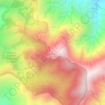
Name: La Ermita topographic map, elevation, terrain.

Location: La Ermita, El Rayo, Risaralda, Colombia (4.89512 -75.71872 4.89522 -75.71862)

Average elevation: 1,768 m

Minimum elevation: 1,389 m

Maximum elevation: 2,038 m

Gear up for your next adventure:

🗺️Topographic Maps - Detailed maps to explore trails, mountains, and wilderness areas
🛶Waterproof Dry Bags - Keep electronics and clothes dry during river crossings
🥘Camping Cookware Set - Compact nesting pots and pans for trail cooking
🧼Travel Hand Sanitizer - Keep hands clean when water is scarce
🧰Multitool Knife - Compact and versatile tool for outdoor use

As an Amazon Associate, this site earns from qualifying purchases at no extra cost to you.