Geolocate

Maguzzano topographic map

Click on the map to display elevation.

About this map

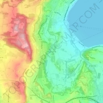
Name: Maguzzano topographic map, elevation, terrain.

Location: Maguzzano, Lonato del Garda, Brescia, Lombardy, 25017, Italy (45.46611 10.48221 45.50611 10.52221)

Average elevation: 143 m

Minimum elevation: 62 m

Maximum elevation: 278 m

Gear up for your next adventure:

🧥Thermal Layer - Insulating layer for cold outdoor conditions
🚑Survival Whistle - Signal for help across long distances in mountains
🕶️Polarized Sunglasses - Protect your eyes with durable polarized lenses
🥤Collapsible Travel Cup - Saves space and weight in your mess kit
🥾Mountaineering Boots - Supportive boots for climbing and high-altitude hiking

As an Amazon Associate, this site earns from qualifying purchases at no extra cost to you.