Geolocate

Kalimpong topographic map

Click on the map to display elevation.

About this map

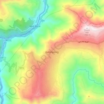
Name: Kalimpong topographic map, elevation, terrain.

Location: Kalimpong, Kalimpong -I, Kalimpong, West Bengal, 734316, India (27.03029 88.43237 27.11029 88.51237)

Average elevation: 834 m

Minimum elevation: 195 m

Maximum elevation: 1,683 m

Gear up for your next adventure:

🧢Sun Hat - Wide-brim hat for sun protection
🧣Merino Neck Gaiter - Protects against wind, sun, and cold at high altitudes
📷Outdoor Action Camera - Capture high-elevation views and rugged adventures
🧦Crew Hiking Socks - Comfortable socks for long-distance hikes
🧥Thermal Layer - Insulating layer for cold outdoor conditions

As an Amazon Associate, this site earns from qualifying purchases at no extra cost to you.