Geolocate

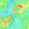
Montvue topographic map

Click on the map to display elevation.

About this map

Name: Montvue topographic map, elevation, terrain.

Location: Montvue, Bearden, Knoxville, Knox County, East Tennessee, Tennessee, 37909, United States (35.90091 -84.06213 35.94091 -84.02213)

Average elevation: 301 m

Minimum elevation: 267 m

Maximum elevation: 338 m

Other topographic maps

Click on a map to view its topography, its elevation and its terrain.
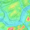
Holston Hills

United States > Tennessee > Knox County > Knoxville

Average elevation: 273 m

Gear up for your next adventure:

🥾Waterproof Hiking Boots - Boots keeping your feet dry in wet conditions
🦟Insect Repellent - Keep mosquitoes and black flies away in wooded areas
🧳Compression Sacks - Maximize space in your backpack by shrinking gear
🧦Thermal Socks - Warm socks for winter hiking or camping
💧Filtered Water Bottle - Safe drinking water on the go

As an Amazon Associate, this site earns from qualifying purchases at no extra cost to you.