Geolocate

Chanderiya topographic map

Click on the map to display elevation.

About this map

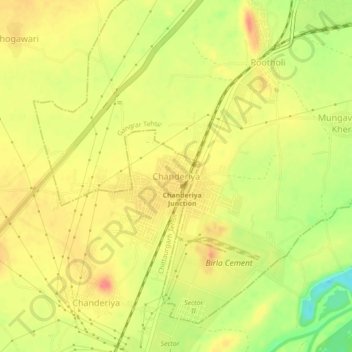
Name: Chanderiya topographic map, elevation, terrain.

Location: Chanderiya, Chittaurgarh Tehsil, Chittorgarh District, Rajasthan, 312021, India (24.91927 74.60826 24.95927 74.64826)

Average elevation: 404 m

Minimum elevation: 366 m

Maximum elevation: 427 m

Other topographic maps

Click on a map to view its topography, its elevation and its terrain.

Gear up for your next adventure:

🌡️Emergency Mylar Blankets - Compact thermal protection for unexpected nights outdoors
🔦LED Headtorch - Bright and durable light for night activities
Lightweight Backpacking Tent - Compact tent for efficient hiking trips
🥾Durable Hiking Shoes - Long-lasting shoes for frequent hiking
🧥Fleece Jacket - Warm and lightweight jacket for layering

As an Amazon Associate, this site earns from qualifying purchases at no extra cost to you.