Geolocate

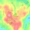
Berkshire topographic map

Click on the map to display elevation.

About this map

Name: Berkshire topographic map, elevation, terrain.

Location: Berkshire, Newtown, Western Connecticut Planning Region, Connecticut, 06482, United States (41.38871 -73.27956 41.42871 -73.23956)

Average elevation: 116 m

Minimum elevation: 28 m

Maximum elevation: 186 m

Other topographic maps

Click on a map to view its topography, its elevation and its terrain.
Gear up for your next adventure:

🚑Survival Whistle - Signal for help across long distances in mountains
🧥Ultralight Puffy Jacket - Maximum warmth that packs down to the size of an orange
🌬️Windproof Camp Stove - Efficient cooking even on exposed mountain peaks
🥾Light Hiking Boots - Lightweight and comfortable boots for day hikes
🧭GPS Outdoor Watch - Smart watch for navigation and fitness tracking in nature

As an Amazon Associate, this site earns from qualifying purchases at no extra cost to you.