Geolocate

Yumbo topographic map

Click on the map to display elevation.

About this map

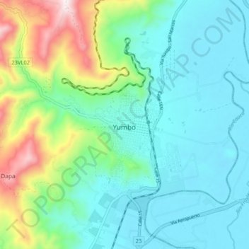
Name: Yumbo topographic map, elevation, terrain.

Location: Yumbo, Sur, Valle del Cauca, 032, Colombia (3.54347 -76.53522 3.62347 -76.45522)

Average elevation: 1,113 m

Minimum elevation: 934 m

Maximum elevation: 1,698 m

Gear up for your next adventure:

🎒Backpack Rain Cover - External shield to keep your entire pack dry
🏃Hydration Running Vest - Carry water and maps close to your body for speed
🧥Thermal Layer - Insulating layer for cold outdoor conditions
🧦Hiking Liner Socks - Thin base layer to prevent friction and blisters
🛁Quick-Dry Microfiber Towel - Space-saving towel that dries rapidly on the move

As an Amazon Associate, this site earns from qualifying purchases at no extra cost to you.