Geolocate

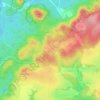
Troskovice topographic map

Click on the map to display elevation.

About this map

Name: Troskovice topographic map, elevation, terrain.

Location: Troskovice, okres Semily, Liberec Region, Czechia (50.49420 15.17804 50.52558 15.24331)

Average elevation: 321 m

Minimum elevation: 259 m

Maximum elevation: 454 m

Other topographic maps

Click on a map to view its topography, its elevation and its terrain.

Stoupa

Czechia > Liberec Region

Average elevation: 328 m

Trosky Castle

Czechia > Liberec Region > Troskovice > Tachov

Average elevation: 320 m

Stoupa

Czechia > Liberec Region > SO ORP Turnov > Karlovice

Average elevation: 328 m

Gear up for your next adventure:

🧰Emergency Multi-Tool - Compact multi-tool for outdoor survival
🧣Merino Neck Gaiter - Protects against wind, sun, and cold at high altitudes
💧Hydration Pack - Hands-free hydration system for long hikes
🧢Hiking Sun Hat - Wide-brimmed protection for exposed mountain ridges
👟Leg Gaiters - Keep debris, mud, and snow out of your boots

As an Amazon Associate, this site earns from qualifying purchases at no extra cost to you.