Geolocate

Samaniego topographic map

Click on the map to display elevation.

About this map

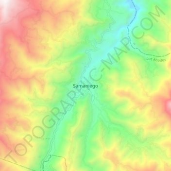
Name: Samaniego topographic map, elevation, terrain.

Location: Samaniego, Los Abades, Nariño, Colombia (1.29850 -77.63294 1.37850 -77.55294)

Average elevation: 1,942 m

Minimum elevation: 1,227 m

Maximum elevation: 2,879 m

Gear up for your next adventure:

👖Convertible Hiking Pants - Zip-off legs to adapt to changing weather conditions
🚲Heavy Duty Bike Lock - Secure your bike at the trailhead or during stops
🧢Outdoor Cap - Protective cap for sun and rain during hikes
🦟Insect Repellent - Keep mosquitoes and black flies away in wooded areas
🧢Outdoor Visor - Breathable visor for sunny hikes

As an Amazon Associate, this site earns from qualifying purchases at no extra cost to you.