Geolocate

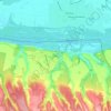
Ostrovo topographic map

Click on the map to display elevation.

About this map

Name: Ostrovo topographic map, elevation, terrain.

Location: Ostrovo, Općina Markušica, Vukovar-Srijem County, 32211, Croatia (45.31699 18.75981 45.36571 18.82828)

Average elevation: 89 m

Minimum elevation: 80 m

Maximum elevation: 104 m

Other topographic maps

Click on a map to view its topography, its elevation and its terrain.
Babina Greda

Croatia > Vukovar-Srijem County

Average elevation: 84 m

Ilok

Croatia > Vukovar-Srijem County

Average elevation: 119 m

Gunja

Croatia > Vukovar-Srijem County

Average elevation: 84 m

Gear up for your next adventure:

🧢Sun Hat - Wide-brim hat for sun protection
🧢Hiking Hat - Sun-protective and breathable hats for long treks
🦯Trekking Poles - Reduced impact on joints for steep topographic climbs
🛰️Satellite Messenger - Emergency communication for areas with no cell service
🥾Trail Hiking Boots - Supportive boots for rough trails

As an Amazon Associate, this site earns from qualifying purchases at no extra cost to you.