Geolocate

Ossuccio topographic map

Click on the map to display elevation.

About this map
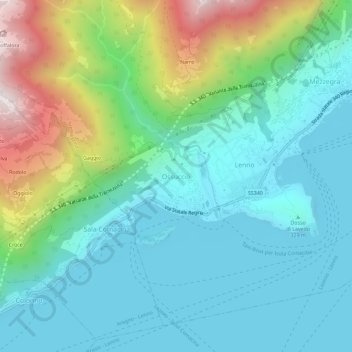
Name: Ossuccio topographic map, elevation, terrain.

Location: Ossuccio, Tremezzina, Como, Lombardy, 22016, Italy (45.95166 9.15962 45.99166 9.19962)

Average elevation: 461 m

Minimum elevation: 184 m

Maximum elevation: 1,284 m

Gear up for your next adventure:

🔭Compact Monocular - One-handed bird watching and trail spotting
🛏️Sleeping Bag - Warm and compact sleeping bags for outdoor camping
💧Collapsible Water Bottle - Space-saving water bottle for outdoor activities
🧢Hiking Hat - Sun-protective and breathable hats for long treks
🔋Emergency Crank Radio - Weather alerts and power without needing batteries

As an Amazon Associate, this site earns from qualifying purchases at no extra cost to you.