Geolocate

Lago di Corlo topographic map

Click on the map to display elevation.

About this map

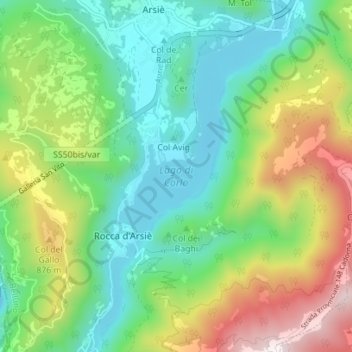
Name: Lago di Corlo topographic map, elevation, terrain.

Location: Lago di Corlo, Rocca d'Arsiè, Arsiè, Belluno, Veneto, Italy (45.93617 11.74585 45.98479 11.78413)

Average elevation: 592 m

Minimum elevation: 249 m

Maximum elevation: 1,285 m

Gear up for your next adventure:

🧴Sunscreen SPF - Broad-spectrum sunscreen for outdoor activities
🛶Waterproof Dry Bags - Keep electronics and clothes dry during river crossings
🥾Hiking Gaiters - Protect legs and shoes from mud, snow, and debris
🥾Waterproof Hiking Boots - Essential footwear for rugged terrain and wet Canadian trails
🚲Heavy Duty Bike Lock - Secure your bike at the trailhead or during stops

As an Amazon Associate, this site earns from qualifying purchases at no extra cost to you.