Geolocate

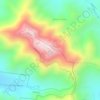
Mount Archer topographic map

Click on the map to display elevation.

About this map

Name: Mount Archer topographic map, elevation, terrain.

Location: Mount Archer, Rockhampton, Queensland, Australia (-23.35097 150.54822 -23.29817 150.61327)

Average elevation: 264 m

Minimum elevation: 53 m

Maximum elevation: 592 m

Other topographic maps

Click on a map to view its topography, its elevation and its terrain.

Mount Archer

Australia > Queensland > Rockhampton

Average elevation: 300 m

Mount Standish

Australia > Queensland > Rockhampton

Average elevation: 289 m

Cameron's Corner

Australia > Queensland > Rockhampton

Average elevation: 11 m

Gear up for your next adventure:

🦶Anti-Blister Balm - Prevents friction and hotspots during long ascents
🧤Thermal Hiking Gloves - Grip-enhanced gloves for cold-weather altitude trekking
🥾Lightweight Hiking Boots - Boots for comfort and mobility on long hikes
🥾Durable Hiking Shoes - Long-lasting shoes for frequent hiking
🚑Survival Whistle - Signal for help across long distances in mountains

As an Amazon Associate, this site earns from qualifying purchases at no extra cost to you.