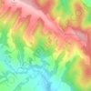
Brezov topographic map
Click on the map to display elevation.
Brezov
The municipality lies at an altitude of 190 metres (620 ft) and covers an area of 6.89 km2 (2.66 sq mi) (2025).
About this map

Name: Brezov topographic map, elevation, terrain.
Location: Brezov, District of Bardejov, Region of Prešov, Slovakia (49.12623 21.48242 49.15930 21.53679)
Average elevation: 238 m
Minimum elevation: 175 m
Maximum elevation: 371 m
Other topographic maps
Click on a map to view its topography, its elevation and its terrain.