Geolocate

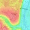
La Royale topographic map

Click on the map to display elevation.

About this map

Name: La Royale topographic map, elevation, terrain.

Location: La Royale, Saint-Germain-en-Laye, Yvelines, Île-de-France, France métropolitaine, 78100, France (48.86889 2.05636 48.90889 2.09636)

Average elevation: 95 m

Minimum elevation: 25 m

Maximum elevation: 184 m

Other topographic maps

Click on a map to view its topography, its elevation and its terrain.
Gear up for your next adventure:

🛶Kayak Accessories - Essential gear for safe and fun kayaking adventures
🧊Insulated Water Bottle - Keeps drinks cold in summer and prevents freezing in winter
🔪Outdoor Multitool - Versatile tool for repairs and food prep in the wild
🧢Beanie Hat - Keep your head warm in cold weather
🥾Mountain Hiking Boots - High-traction boots for rocky terrain

As an Amazon Associate, this site earns from qualifying purchases at no extra cost to you.