Geolocate

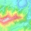
Devchuli topographic map

Click on the map to display elevation.

About this map

Name: Devchuli topographic map, elevation, terrain.

Location: Devchuli, Nawalpur District, Gandaki Province, 33004, Nepal (27.65106 84.14832 27.77748 84.26200)

Average elevation: 564 m

Minimum elevation: 145 m

Maximum elevation: 1,855 m

Other topographic maps

Click on a map to view its topography, its elevation and its terrain.

Kawasoti

Nepal > Gandaki Province > Nawalpur District

Average elevation: 183 m

Chormara

Nepal > Gandaki Province > Nawalpur District

Average elevation: 191 m

Udaypur

Nepal > Gandaki Province > Nawalpur District

Average elevation: 431 m

Gear up for your next adventure:

🪜Heavy Duty Carabiners - Multi-use clips for securing gear to your backpack
👟Leg Gaiters - Keep debris, mud, and snow out of your boots
🥽Outdoor Goggles - Protective eyewear for outdoor activities
⛺Camping Tent - Weather-resistant tents suitable for 2 to 6 people
🔋Solar Power Bank - Keep your GPS and devices charged during long outdoor trips

As an Amazon Associate, this site earns from qualifying purchases at no extra cost to you.