Geolocate

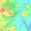
Moeraki topographic map

Click on the map to display elevation.

About this map

Name: Moeraki topographic map, elevation, terrain.

Location: Moeraki, Waitaki District, Otago, 9482, New Zealand (-45.38099 170.83151 -45.34099 170.87151)

Average elevation: 19 m

Minimum elevation: 0 m

Maximum elevation: 152 m

Other topographic maps

Click on a map to view its topography, its elevation and its terrain.

Kakanui Mountains

New Zealand > Otago > Waitaki District

Average elevation: 784 m

Kakanui River

New Zealand > Otago > Waitaki District

Average elevation: 315 m

Pleasant River

New Zealand > Otago > Waitaki District

Average elevation: 108 m

Gear up for your next adventure:

🥾Hiking Boots - Sturdy boots providing ankle support and traction on rugged trails
⛺Family Camping Tent - Spacious tent suitable for family camping trips
🥾Waterproof Trail Shoes - Shoes designed to handle wet terrain
🔥Emergency Fire Starter - Reliable ignition source for all weather conditions
💡Portable Camping Lamp - Rechargeable lamp for campsite lighting

As an Amazon Associate, this site earns from qualifying purchases at no extra cost to you.