Geolocate

Karuizawa topographic map

Click on the map to display elevation.

About this map
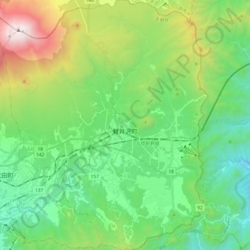
Name: Karuizawa topographic map, elevation, terrain.

Location: Karuizawa, Kitasaku County, Nagano Prefecture, Japan (36.27840 138.50749 36.42439 138.65716)

Average elevation: 1,117 m

Minimum elevation: 535 m

Maximum elevation: 2,563 m

Gear up for your next adventure:

🍽️Titanium Camping Spork - Ultralight and indestructible eating utensil
🛶Kayak Accessories - Essential gear for safe and fun kayaking adventures
🧤Thermal Hiking Gloves - Grip-enhanced gloves for cold-weather altitude trekking
🧴Outdoor Sunscreen - High SPF protection for high-altitude UV exposure
🚲Bike Repair Kit - Essential tools for on-trail mechanical issues

As an Amazon Associate, this site earns from qualifying purchases at no extra cost to you.