
Thank you for supporting this site ❤️
Make a donation
Make a donation
Gear up for your next adventure:
As an Amazon Associate, this site earns from qualifying purchases at no extra cost to you.
Karuizawa topographic map
Click on the map to display elevation.
Thank you for supporting this site ❤️
Make a donation
Make a donation
Gear up for your next adventure:
As an Amazon Associate, this site earns from qualifying purchases at no extra cost to you.
About this map
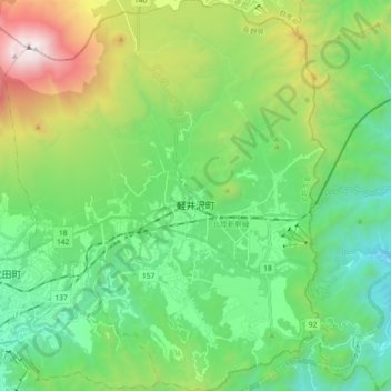
Name: Karuizawa topographic map, elevation, terrain.
Location: Karuizawa, Kitasaku County, Nagano Prefecture, Japan (36.27840 138.50749 36.42439 138.65716)
Average elevation: 1,117 m
Minimum elevation: 535 m
Maximum elevation: 2,563 m
Thank you for supporting this site ❤️
Make a donation
Make a donation
Gear up for your next adventure:
As an Amazon Associate, this site earns from qualifying purchases at no extra cost to you.