Geolocate

Kosamba topographic map

Click on the map to display elevation.

About this map

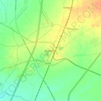
Name: Kosamba topographic map, elevation, terrain.

Location: Kosamba, Mangrol Taluka, Surat, Gujarat, 394120, India (21.42662 72.91186 21.50662 72.99186)

Average elevation: 23 m

Minimum elevation: 8 m

Maximum elevation: 40 m

Gear up for your next adventure:

💧Filtered Water Bottle - Safe drinking water on the go
🧴Insect Repellent - Protect yourself from bugs during outdoor adventures
🧢Beanie Hat - Keep your head warm in cold weather
🧢Sun Hat - Wide-brim hat for sun protection
🛶Kayak Dry Bag - Waterproof storage for kayaking adventures

As an Amazon Associate, this site earns from qualifying purchases at no extra cost to you.