Geolocate

Jōzuka topographic map

Click on the map to display elevation.

About this map

Name: Jōzuka topographic map, elevation, terrain.

Location: Jōzuka, Takaoka, Toyama Prefecture, 933-0021, Japan (36.72564 136.99662 36.76564 137.03662)

Average elevation: 11 m

Minimum elevation: 0 m

Maximum elevation: 22 m

Other topographic maps

Click on a map to view its topography, its elevation and its terrain.
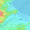
Takaoka

Japan > Takaoka

Average elevation: 41 m

Gear up for your next adventure:

🛶Canoe Life Vest - Safety vest for water sports
🥾Trekking Boots - Durable boots for long-distance trekking
🧣Evaporative Cooling Towel - Beat the heat during intense summer climbs
🥾Trail Hiking Socks - Comfortable socks to prevent blisters and fatigue
🧴Bear Spray Holster - Quick-access carry for essential Canadian wilderness safety

As an Amazon Associate, this site earns from qualifying purchases at no extra cost to you.