Geolocate

La Macarena topographic map

Click on the map to display elevation.

About this map

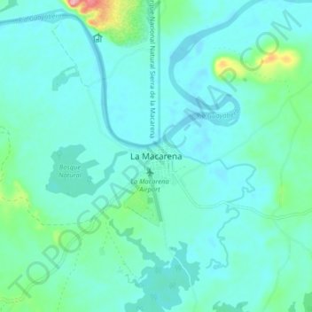
Name: La Macarena topographic map, elevation, terrain.

Location: La Macarena, Meta, Colombia (2.14338 -73.82579 2.22338 -73.74579)

Average elevation: 235 m

Minimum elevation: 214 m

Maximum elevation: 351 m

Other topographic maps

Click on a map to view its topography, its elevation and its terrain.

Caño

Colombia > Meta > La Macarena

Average elevation: 256 m

El Vergel

Colombia > Meta > La Macarena

Average elevation: 256 m

Caño Cristales

Colombia > Meta > La Macarena

Average elevation: 290 m

El Turpial

Colombia > Meta > La Macarena

Average elevation: 253 m

Gear up for your next adventure:

🥾Hiking Boots - Sturdy boots providing ankle support and traction on rugged trails
🛌Down Sleeping Bag - Superior warmth-to-weight ratio for cold nights
🥾Mountaineering Boots - Supportive boots for climbing and high-altitude hiking
🧴Insect Repellent - Protect yourself from bugs during outdoor adventures
🛶Canoe Life Vest - Safety vest for water sports

As an Amazon Associate, this site earns from qualifying purchases at no extra cost to you.