Geolocate

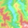
Emirefendi Mahallesi topographic map

Click on the map to display elevation.

About this map

Name: Emirefendi Mahallesi topographic map, elevation, terrain.

Location: Emirefendi Mahallesi, Bafra, Samsun, Black Sea Region, Turkey (41.55622 35.89972 41.56251 35.91442)

Average elevation: 38 m

Minimum elevation: 16 m

Maximum elevation: 112 m

Other topographic maps

Click on a map to view its topography, its elevation and its terrain.

Esençay

Turkey > Bafra

Average elevation: 371 m

İlyaslı

Turkey > Bafra

Average elevation: 196 m

Kolay

Turkey > Bafra

Average elevation: 249 m

Yeraltı

Turkey > Bafra

Average elevation: 399 m

Fener

Turkey > Bafra

Average elevation: 6 m

Gear up for your next adventure:

🥾Mountain Hiking Boots - High-traction boots for rocky terrain
🧼Travel Hand Sanitizer - Keep hands clean when water is scarce
🍽️Titanium Camping Spork - Ultralight and indestructible eating utensil
🧦Thermal Socks - Warm socks for winter hiking or camping
🧣Evaporative Cooling Towel - Beat the heat during intense summer climbs

As an Amazon Associate, this site earns from qualifying purchases at no extra cost to you.