
Atenas topographic map
Interactive map
Click on the map to display elevation.
About this map
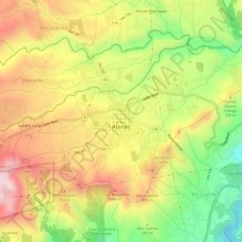
Name: Atenas topographic map, elevation, terrain.
Location: Atenas, Cantón Atenas, Provincia Alajuela, 20501, Costa Rica (9.96027 -84.39608 9.99687 -84.34101)
Average elevation: 682 m
Minimum elevation: 376 m
Maximum elevation: 971 m