
Thank you for supporting this site ❤️
Make a donation
Make a donation
Gear up for your next adventure:
As an Amazon Associate, this site earns from qualifying purchases at no extra cost to you.
Budens topographic map
Click on the map to display elevation.
Thank you for supporting this site ❤️
Make a donation
Make a donation
Gear up for your next adventure:
As an Amazon Associate, this site earns from qualifying purchases at no extra cost to you.
About this map
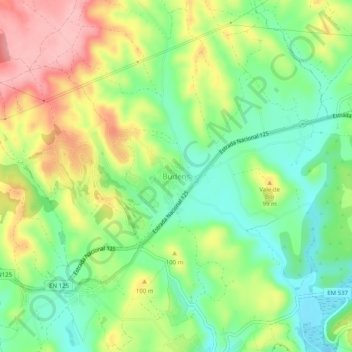
Name: Budens topographic map, elevation, terrain.
Location: Budens, Vila do Bispo, Faro, Algarve, 8650-060, Portugal (37.06671 -8.85038 37.10671 -8.81038)
Average elevation: 59 m
Minimum elevation: -3 m
Maximum elevation: 139 m
Thank you for supporting this site ❤️
Make a donation
Make a donation
Gear up for your next adventure:
As an Amazon Associate, this site earns from qualifying purchases at no extra cost to you.