Geolocate

Pesalakan topographic map

Click on the map to display elevation.

About this map

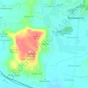
Name: Pesalakan topographic map, elevation, terrain.

Location: Pesalakan, Kebumen, Central Java, Java, Indonesia (-7.71224 109.70840 -7.67224 109.74840)

Average elevation: 34 m

Minimum elevation: 2 m

Maximum elevation: 141 m

Gear up for your next adventure:

🧭GPS Outdoor Watch - Smart watch for navigation and fitness tracking in nature
🦶Anti-Blister Balm - Prevents friction and hotspots during long ascents
🧢Outdoor Visor - Breathable visor for sunny hikes
🎒Hiking Daypack - Lightweight and durable backpacks for day trips and excursions
🥾Mountain Hiking Shoes - Shoes with superior grip for mountainous terrain

As an Amazon Associate, this site earns from qualifying purchases at no extra cost to you.