Geolocate

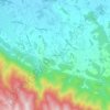
84580 topographic map

Click on the map to display elevation.

About this map

Name: 84580 topographic map, elevation, terrain.

Location: 84580, Oppède, Apt, Vaucluse, Provence-Alpes-Côte d'Azur, France métropolitaine, France (43.79845 5.14238 43.86801 5.19873)

Average elevation: 303 m

Minimum elevation: 95 m

Maximum elevation: 727 m

Other topographic maps

Click on a map to view its topography, its elevation and its terrain.
Gear up for your next adventure:

🧴First Aid Kit - Essential first aid supplies for outdoor emergencies
⛺Bushcraft Tarp - Versatile emergency shelter or gear protection
🦟Insect Repellent - Keep mosquitoes and black flies away in wooded areas
💧Filtered Water Bottle - Safe drinking water on the go
🧭Orienteering Kit - Tools for map reading and navigation in the wild

As an Amazon Associate, this site earns from qualifying purchases at no extra cost to you.