
البحيرة topographic map
Interactive map
Click on the map to display elevation.
About this map
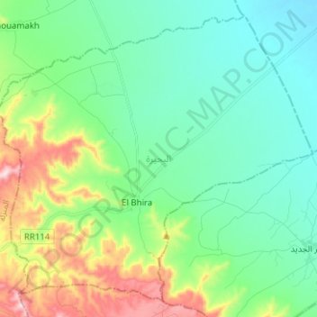
Name: البحيرة topographic map, elevation, terrain.
Location: البحيرة, معتمدية بني خداش, Médenine, Tunisia (33.28411 10.17100 33.37867 10.29640)
Average elevation: 275 m
Minimum elevation: 157 m
Maximum elevation: 600 m