Geolocate

Cucamonga Wilderness topographic map

Click on the map to display elevation.

Cucamonga Wilderness

Elevations range from about 5,000 to 9,000 feet (1,500 to 2,700 m).

Wikipedia (CC-BY-SA 3.0)

About this map

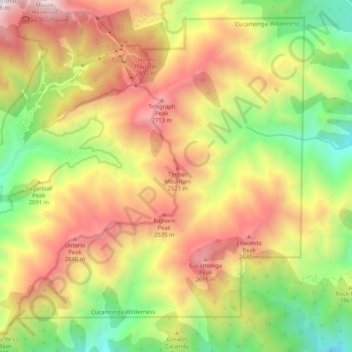
Name: Cucamonga Wilderness topographic map, elevation, terrain.

Location: Cucamonga Wilderness, Mount Baldy, San Bernardino County, California, 92358, United States (34.20426 -117.66028 34.28194 -117.55613)

Average elevation: 2,021 m

Minimum elevation: 1,138 m

Maximum elevation: 2,974 m

Gear up for your next adventure:

🥾Lightweight Hiking Shoes - Comfortable shoes for day hikes
🔋Solar Power Bank - Keep your GPS and devices charged during long outdoor trips
🥾Waterproof Hiking Shoes - Durable shoes for wet and rugged trails
🥫Freeze-Dried Meals - Lightweight, high-calorie nutrition for multi-day treks
💡Compact LED Flashlight - Powerful and portable flashlight for outdoor use

As an Amazon Associate, this site earns from qualifying purchases at no extra cost to you.