Geolocate

Baranda topographic map

Click on the map to display elevation.

About this map

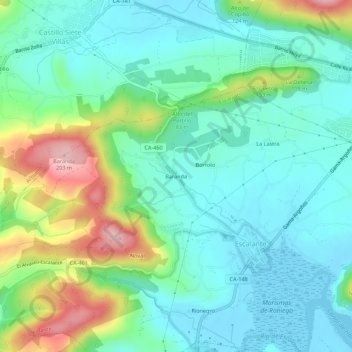
Name: Baranda topographic map, elevation, terrain.

Location: Baranda, Escalante, Cantabria, 39795, Spain (43.42474 -3.54558 43.46474 -3.50558)

Average elevation: 54 m

Minimum elevation: -1 m

Maximum elevation: 197 m

Gear up for your next adventure:

🥾Trail Hiking Socks - Comfortable socks to prevent blisters and fatigue
🦶Hiking Shoe Insoles - Added support for high arches and long days on feet
🥾Hiking Gaiters - Protect legs and shoes from mud, snow, and debris
🌬️Windproof Camp Stove - Efficient cooking even on exposed mountain peaks
💡LED Headlamp - Hands-free illumination for night hiking and camping

As an Amazon Associate, this site earns from qualifying purchases at no extra cost to you.