Geolocate

Agognate topographic map

Click on the map to display elevation.

About this map

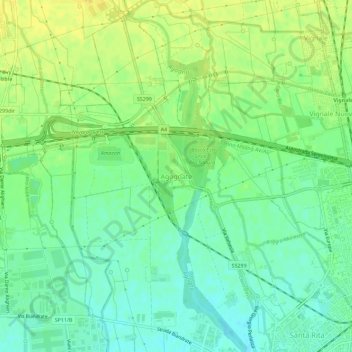
Name: Agognate topographic map, elevation, terrain.

Location: Agognate, Novara, Piemonte, 28100, Italia (45.44952 8.56606 45.48952 8.60606)

Average elevation: 158 m

Minimum elevation: 147 m

Maximum elevation: 169 m

Gear up for your next adventure:

🥾Light Hiking Boots - Lightweight and comfortable boots for day hikes
🧥Waterproof Pants - Keep dry during rainy hiking conditions
🔥Emergency Fire Starter - Reliable ignition source for all weather conditions
🥾Mountaineering Boots - Supportive boots for climbing and high-altitude hiking
💧Collapsible Water Bottle - Space-saving water bottle for outdoor activities

As an Amazon Associate, this site earns from qualifying purchases at no extra cost to you.