
Vinhedo topographic map
Click on the map to display elevation.
Vinhedo
Vinhedo (Portuguese pronunciation: [viˈɲedu]) is a municipality in the state of São Paulo in Brazil. It is part of the Metropolitan Region of Campinas. The population in 2020 was 80,111 and its area is 81.60 km2 (31.51 sq mi). It has a population density of 981 inhabitants per square kilometer. The elevation is 777 m (2,549 ft). Vinhedo is 96% urbanized and It was founded in 1949.
About this map
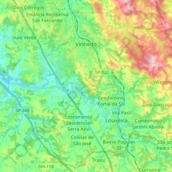
Name: Vinhedo topographic map, elevation, terrain.
Average elevation: 735 m
Minimum elevation: 623 m
Maximum elevation: 981 m
Other topographic maps
Click on a map to view its topography, its elevation and its terrain.