Geolocate

Funes topographic map

Click on the map to display elevation.

About this map

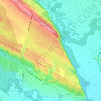
Name: Funes topographic map, elevation, terrain.

Location: Funes, Erriberagoiena / Ribera Alta, 31360, Spain (42.24025 -1.85729 42.32936 -1.74391)

Average elevation: 328 m

Minimum elevation: 268 m

Maximum elevation: 464 m

Other topographic maps

Click on a map to view its topography, its elevation and its terrain.

Sierras

Spain > Erriberagoiena / Ribera Alta > Falces

Average elevation: 427 m

Gear up for your next adventure:

🔪Outdoor Multitool - Versatile tool for repairs and food prep in the wild
🧢Beanie Hat - Keep your head warm in cold weather
🔨Vehicle Emergency Tool - Safety tool for remote road trips to trailheads
🔋Lithium AA Batteries - Long-lasting power that performs in extreme cold
🧥Insulated Jacket - Keep warm in cold outdoor conditions

As an Amazon Associate, this site earns from qualifying purchases at no extra cost to you.