
Thank you for supporting this site ❤️
Make a donation
Make a donation
Gear up for your next adventure:
As an Amazon Associate, this site earns from qualifying purchases at no extra cost to you.
Arnsberg topographic map
Click on the map to display elevation.
Thank you for supporting this site ❤️
Make a donation
Make a donation
Gear up for your next adventure:
As an Amazon Associate, this site earns from qualifying purchases at no extra cost to you.
About this map
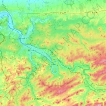
Name: Arnsberg topographic map, elevation, terrain.
Location: Arnsberg, Hochsauerlandkreis, North Rhine-Westphalia, Germany (51.35475 7.86403 51.49133 8.21026)
Average elevation: 281 m
Minimum elevation: 137 m
Maximum elevation: 578 m
Thank you for supporting this site ❤️
Make a donation
Make a donation
Gear up for your next adventure:
As an Amazon Associate, this site earns from qualifying purchases at no extra cost to you.