
Lowden topographic map
Interactive map
Click on the map to display elevation.
About this map
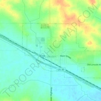
Name: Lowden topographic map, elevation, terrain.
Location: Lowden, Cedar County, Iowa, United States of America (41.85167 -90.93719 41.86637 -90.90766)
Average elevation: 227 m
Minimum elevation: 213 m
Maximum elevation: 251 m