
Stavropol Krai topographic map
Interactive map
Click on the map to display elevation.
About this map
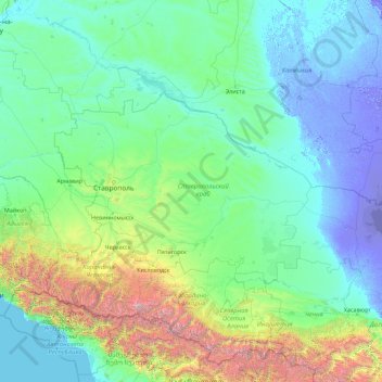
Name: Stavropol Krai topographic map, elevation, terrain.
Location: Stavropol Krai, North Caucasus federal district, Russia (42.30326 40.88069 47.42326 46.00069)
Average elevation: 441 m
Minimum elevation: -29 m
Maximum elevation: 5,452 m
Other topographic maps
Click on a map to view its topography, its elevation and its terrain.