Geolocate

Peruyes topographic map

Click on the map to display elevation.

About this map

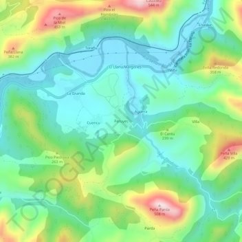
Name: Peruyes topographic map, elevation, terrain.

Location: Peruyes, Cangas de Onís, Asturias, 33547, Spain (43.38069 -5.12887 43.42069 -5.08887)

Average elevation: 153 m

Minimum elevation: 6 m

Maximum elevation: 486 m

Other topographic maps

Click on a map to view its topography, its elevation and its terrain.

Cuadonga / Covadonga

Spain > Asturias > Cangas de Onís

Average elevation: 503 m

Gear up for your next adventure:

🧥Thermal Layer - Insulating layer for cold outdoor conditions
📷Outdoor Action Camera - Capture high-elevation views and rugged adventures
🔥Emergency Fire Starter - Reliable ignition source for all weather conditions
🧰Survival Kit - Essential gear for emergencies in the wilderness
🧳Compression Sacks - Maximize space in your backpack by shrinking gear

As an Amazon Associate, this site earns from qualifying purchases at no extra cost to you.