
Beaverhead County topographic map
Interactive map
Click on the map to display elevation.
About this map
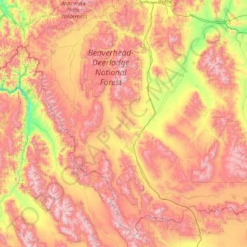
Name: Beaverhead County topographic map, elevation, terrain.
Location: Beaverhead County, Montana, États-Unis (44.35792 -113.93810 45.94152 -111.46354)
Average elevation: 2,076 m
Minimum elevation: 1,115 m
Maximum elevation: 3,412 m
Other topographic maps
Click on a map to view its topography, its elevation and its terrain.
Hungry Horse
États-Unis > Montana > Hungry Horse
Hungry Horse, Flathead County, Montana, 59926, États-Unis
Average elevation: 1,070 m