
Thank you for supporting this site ❤️
Make a donation
Make a donation
Gear up for your next adventure:
As an Amazon Associate, this site earns from qualifying purchases at no extra cost to you.
Arnadelo topographic map
Click on the map to display elevation.
Thank you for supporting this site ❤️
Make a donation
Make a donation
Gear up for your next adventure:
As an Amazon Associate, this site earns from qualifying purchases at no extra cost to you.
About this map
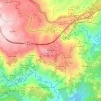
Name: Arnadelo topographic map, elevation, terrain.
Location: Arnadelo, Torgueda, Vila Real, 5000-745, Portugal (41.24215 -7.81057 41.28215 -7.77057)
Average elevation: 481 m
Minimum elevation: 171 m
Maximum elevation: 757 m
Thank you for supporting this site ❤️
Make a donation
Make a donation
Gear up for your next adventure:
As an Amazon Associate, this site earns from qualifying purchases at no extra cost to you.