
Razo topographic map
Interactive map
Click on the map to display elevation.
About this map
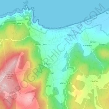
Name: Razo topographic map, elevation, terrain.
Location: Razo, Carballo, Bergantiños, A Coruña, Galicia, 15107, España (43.26197 -8.73699 43.29911 -8.69382)
Average elevation: 123 m
Minimum elevation: -4 m
Maximum elevation: 367 m
Other topographic maps
Click on a map to view its topography, its elevation and its terrain.