Geolocate

Verduga topographic map

Click on the map to display elevation.

About this map

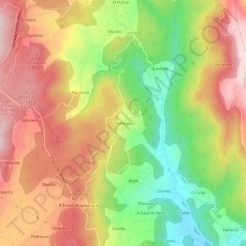
Name: Verduga topographic map, elevation, terrain.

Location: Verduga, Augasantas, Rois, Sar, La Coruña, Galicia, España (42.78728 -8.74848 42.82728 -8.70848)

Average elevation: 296 m

Minimum elevation: 79 m

Maximum elevation: 489 m

Gear up for your next adventure:

🥾Waterproof Hiking Shoes - Durable shoes for wet and rugged trails
🥾Hiking Shoes - Durable and comfortable shoes for trail hiking
🎒Backpack Rain Cover - External shield to keep your entire pack dry
🧥Packable Rain Jacket - Breathable waterproof layer for unpredictable weather
🥾Mountain Hiking Boots - High-traction boots for rocky terrain

As an Amazon Associate, this site earns from qualifying purchases at no extra cost to you.