
Thank you for supporting this site ❤️
Make a donation
Make a donation
Gear up for your next adventure:
As an Amazon Associate, this site earns from qualifying purchases at no extra cost to you.
Lisanza topographic map
Click on the map to display elevation.
Thank you for supporting this site ❤️
Make a donation
Make a donation
Gear up for your next adventure:
As an Amazon Associate, this site earns from qualifying purchases at no extra cost to you.
About this map
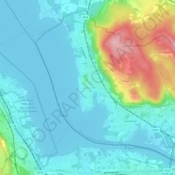
Name: Lisanza topographic map, elevation, terrain.
Location: Lisanza, Sesto Calende, Varese, Lombardia, 28053, Italia (45.71890 8.57981 45.75890 8.61981)
Average elevation: 227 m
Minimum elevation: 191 m
Maximum elevation: 356 m
Thank you for supporting this site ❤️
Make a donation
Make a donation
Gear up for your next adventure:
As an Amazon Associate, this site earns from qualifying purchases at no extra cost to you.