
Thank you for supporting this site ❤️
Make a donation
Make a donation
Gear up for your next adventure:
As an Amazon Associate, this site earns from qualifying purchases at no extra cost to you.
Nawbah topographic map
Click on the map to display elevation.
Thank you for supporting this site ❤️
Make a donation
Make a donation
Gear up for your next adventure:
As an Amazon Associate, this site earns from qualifying purchases at no extra cost to you.
About this map
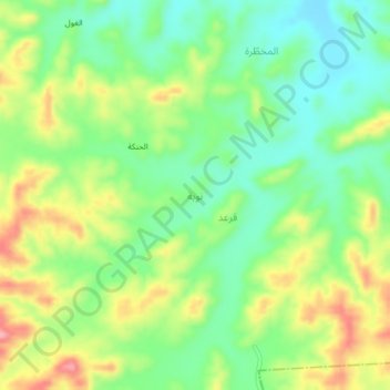
Name: Nawbah topographic map, elevation, terrain.
Location: Nawbah, Al Bayda District, Al Bayda' Governorate, Yemen (13.99186 45.49777 14.03186 45.53777)
Average elevation: 1,990 m
Minimum elevation: 1,938 m
Maximum elevation: 2,068 m
Thank you for supporting this site ❤️
Make a donation
Make a donation
Gear up for your next adventure:
As an Amazon Associate, this site earns from qualifying purchases at no extra cost to you.