Geolocate

Morganville topographic map

Click on the map to display elevation.

About this map

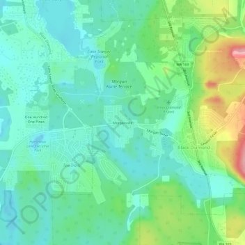
Name: Morganville topographic map, elevation, terrain.

Location: Morganville, Black Diamond, King County, Washington, 98010, United States (47.29232 -122.04095 47.33232 -122.00095)

Average elevation: 185 m

Minimum elevation: 148 m

Maximum elevation: 284 m

Other topographic maps

Click on a map to view its topography, its elevation and its terrain.

Gear up for your next adventure:

🧤Rechargeable Heated Gloves - Extreme warmth for Canadian winter expeditions
🛁Quick-Dry Microfiber Towel - Space-saving towel that dries rapidly on the move
🚲Bike Repair Kit - Essential tools for on-trail mechanical issues
Lightweight Backpacking Tent - Compact tent for efficient hiking trips
🦶Anti-Blister Balm - Prevents friction and hotspots during long ascents

As an Amazon Associate, this site earns from qualifying purchases at no extra cost to you.