
Thank you for supporting this site ❤️
Make a donation
Make a donation
Gear up for your next adventure:
As an Amazon Associate, this site earns from qualifying purchases at no extra cost to you.
Boucheghouf topographic map
Click on the map to display elevation.
Thank you for supporting this site ❤️
Make a donation
Make a donation
Gear up for your next adventure:
As an Amazon Associate, this site earns from qualifying purchases at no extra cost to you.
About this map
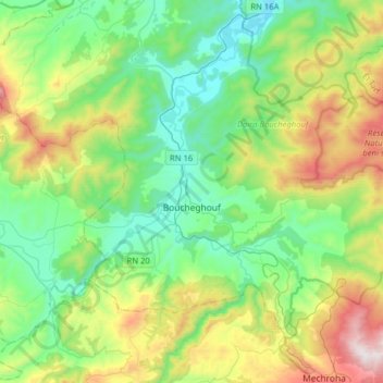
Name: Boucheghouf topographic map, elevation, terrain.
Location: Boucheghouf, Boucheghouf District, Guelma, 24200, Algeria (36.40111 7.63984 36.56021 7.95645)
Average elevation: 356 m
Minimum elevation: 37 m
Maximum elevation: 1,136 m
Thank you for supporting this site ❤️
Make a donation
Make a donation
Gear up for your next adventure:
As an Amazon Associate, this site earns from qualifying purchases at no extra cost to you.